


Longread about my hometown with the letter "Y"
Make yourself comfortable, it will be interesting!

yoshkar-ola —
is europe in the centre of russia?
hover over the photo
To the question “What do you know about Yoshkar-Ola?” I usually get the following answers:

"Yoshkin's cat!"
35%

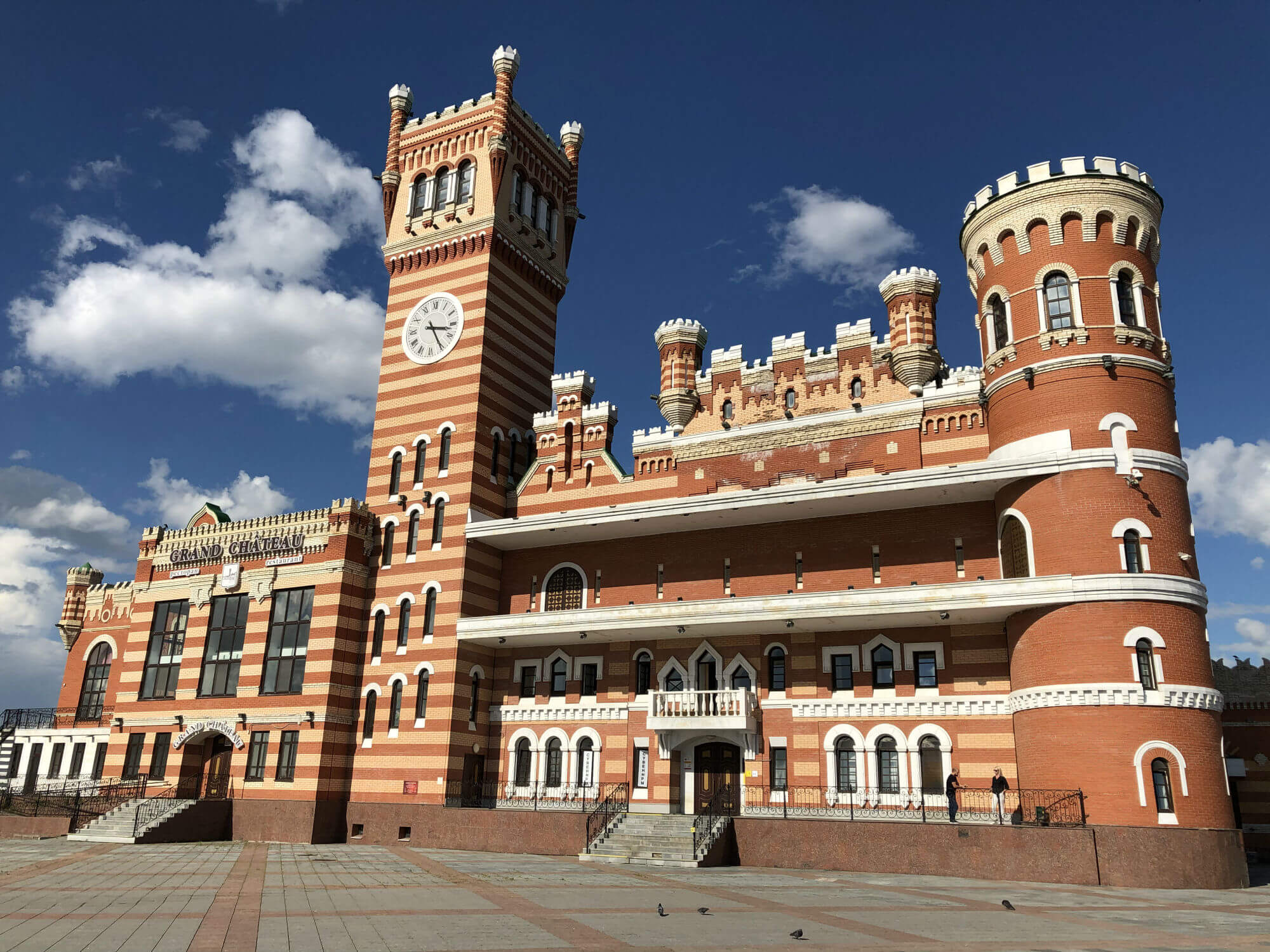
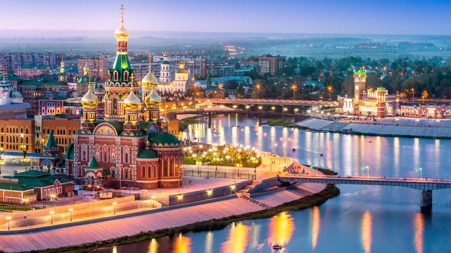
"You have a clock tower like in the Moscow Kremlin and an embankment like in Belgium"
60%

"Is it near Ulan-Ude?"
5%


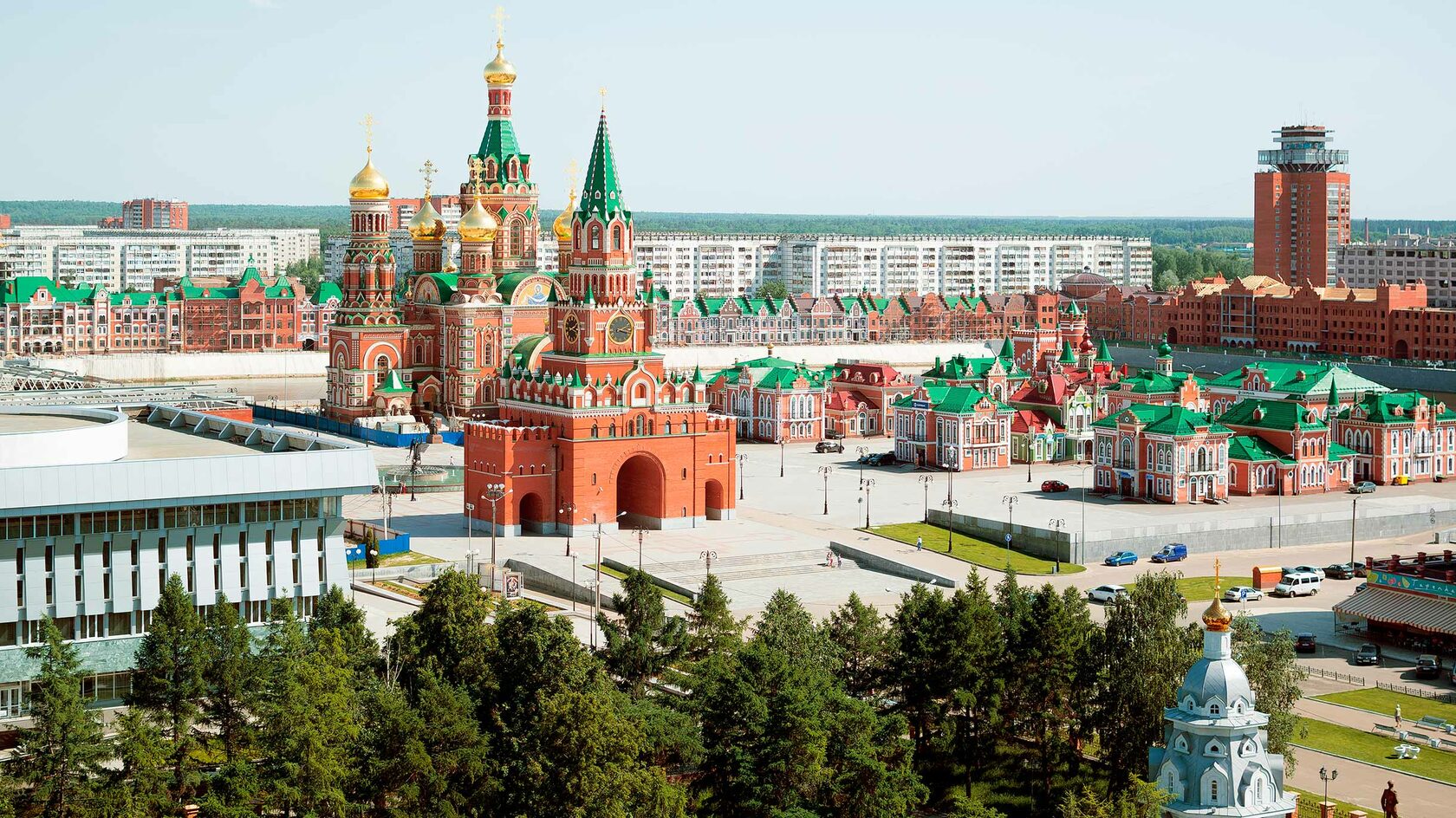
The most popular answer is about copied modern landmarks. And this is partly true, judge for yourself…
Bruges embankment (orig.)
The Church of the Savior on Spilled Blood
Saint Basil's Cathedral
Piazza San Marco
The Spasskaya Tower
Bruges embankment
Annunciation Cathedral
Annunciation tower
Obolensky-Nogotkov Square
But let's not forget,
that yoshkar-ola is…
The capital of the republic with its own history
the original Mari culture
delicious national dishes
unique nature
Therefore, I suggest you get to know this small town better, and we will start with the history

Pay attention to the tips on the site to find out more information :)


Tsarevokokshaisk
Until the middle of the XVI century, the territory of modern Yoshkar-Ola was part of the Galician Daruga of the Kazan Khanate and was inhabited by Mari people.
In October 1552 Ivan the Terrible annexed the lands of the Kazan Khanate to his kingdom
The local population was sworn allegiance to the new sovereign, but soon refused to obey and pay yasak, which caused a widespread uprising.

1584

"I took Kazan, I took Astrakhan, I took Revel, I didn't take Shpak" /movie "Ivan Vasilyevich Changes Occupation"/
To strengthen his power, the tsar decided to build "fortress cities" here. The "Tsarev city on Kokshayka" was founded.
Ivan the Terrible

Yasak is a natural tax, which was levied in Muscovite Rus and tsarist Russia by some peoples of the Volga region, Siberia and the Far East.
Yasak is a natural tax, which was levied in Muscovite Rus and tsarist Russia by some peoples of the Volga region, Siberia and the Far East.


Initially, Tsarevokokshaysk was a typical military fortification with a wooden kremlin, surrounded on four sides by earthen ramparts.
Gradually, the military city turned into a mixed-type city, an economic center, and people began to settle here…

Merchants

Artisans

Peasants


April 12, 1696 is a black date in the history of Tsarevokokshaysk, when the city burned down from a single candle.
1696


"The fire then started from a single candle in the Trinity Church on the eve of Easter. The watchman overlooked it, and the wooden Tsarevokokshaisk really burned down, not even the log fortress walls remained."


A new life has begun for the city —
a new layout, stone construction, which will later determine the "face" of Tsarevokokshaysk.
a new layout, stone construction, which will later determine the "face" of Tsarevokokshaysk.

The most ancient buildings of the XVIII century that you can still see today
Tikhvin Cemetery two-altar Church (1779)


The House of Pchelin (1756)

"The golden period in the development of the city was the XVIII century, especially the years of the reign of Elizabeth Petrovna, it was a time of active stone church and civil urban planning, including the construction of the first school."

And in 2011, a monument will be erected to me on the embankment
Ascension Church (1759)
Hover over the photo


Elizaveta Petrovna

1835
The first regular plan of Tsarevokokshaysk


On March 1, 1835, Emperor Nicholas I approved a regular plan, according to which the city received a rectangular grid of streets.
According to this plan, the city developed further, gradually turning into the commercial, economic and cultural center of the Mari Territory, although its population was only about 2,000 people.
The photo can be enlarged and viewed in more detail

A regular city plan is a special type of urban layout that has a clear and deliberate organization of its streets, neighborhoods and buildings

"So be it"
Nicholas I
A regular city plan is a special type of urban layout that has a clear and deliberate organization of its streets, neighborhoods and buildings


Tsarevokokshaisk remained quiet provincial town, consisting 13 streets and 300 different buildings; in this form, it was preserved almost until the 20s of the XX century.
Krasnokokshaysk — Yoshkar-Ola

1936
The Mari Autonomous Region was transformed into the Mari Autonomous Soviet Socialist Republic, and the city of Yoshkar-Ola becomes its capital.


1919
The city was renamed to Krasnokokshaysk.
1928
The city received the Mari national name— Yoshkar-Ola, which means "Red City" in the Mari language.


During the years of the Great Patriotic War, it was decided to evacuate some factories in Yoshkar-Ola, which gave a powerful impetus to industrial and socio-economic development.

Assembly of sniper sights at plant No. 297

Assembly of sniper sights at plant No. 297

Assembly workshop of plant No. 297

In the workshop of plant No. 297


The ensemble building of the 50s - 60s of the central district of the city was a great achievement of Yoshkar-Ola architects

Gradually, a building was formed along the street Institutskaya (Lenin Avenue), which has become the main street of the city
New buildings of the city administration, government house, Yoshkar-Ola hotel, theater, etc. were erected.

Yoshkar-Ola Hotel

Railway station
(before/after photo by click)
Find out more

The Shketan Theater

Government House

City Administration


Lenin Ave. (formerly Institutskaya St.)


Szombathely

The Szombathely neighborhood is named after the Hungarian sister city of Yoshkar-Ola. In turn, in Szombathely, one of the districts of the city is called Yoshkar-Ola.


The Szombathely neighborhood is named after the Hungarian sister city of Yoshkar-Ola. In turn, in Szombathely, one of the districts of the city is called Yoshkar-Ola.
In the 1970s and 1980s, the largest urban planning event of Yoshkar-Ola was implemented — the development of the left bank of the Kokshaga and the creation of the Szombathely neighborhood
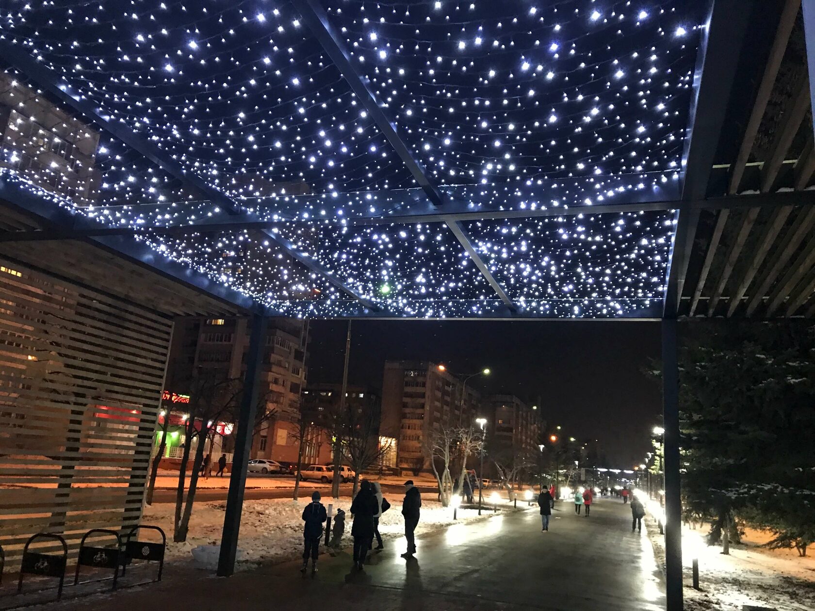
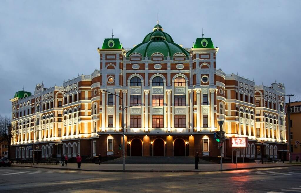
In general, the city has really become more beautiful: new spaces are emerging, territories are being improved, local culture and folklore are being maintained and preserved…
The city has been transformed and has acquired many interesting sights and cultural monuments
..And that's great!
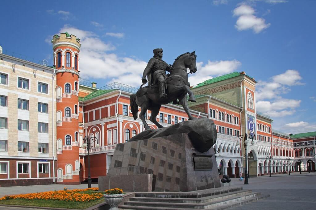
(although some monuments cause me slight perplexity (how are they related to Yoshkar-Ola at all?)


Modern Yoshkar-Ola
The site was developed by
Kovalkova Daria


A non-profit project. All materials belong to the owners.
*banned social network in the territory of the Russian Federation
*banned social network in the territory of the Russian Federation


And this is the puppet theater on the embankment
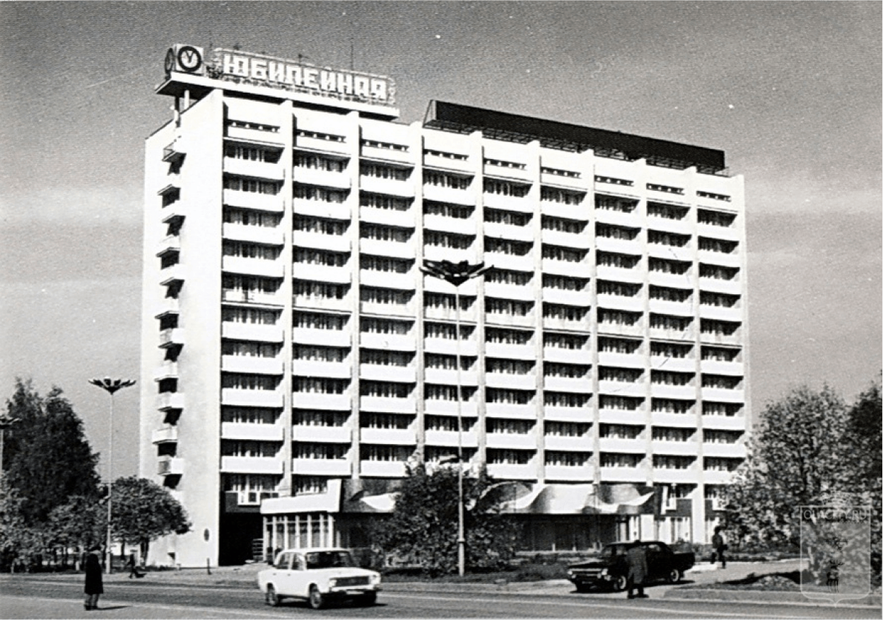


The building of the Yubileynaya Hotel, built in 1980. In 1988, the hotel will change its name to Yoshkar-Ola, and in 2011 the hotel will be demolished, and now the Peoples' Friendship House has been built in its place.


This administrative building was built according to the project of architect S.A.Kleimenov and was commissioned in 1971.


The Mari State Drama Theater named after Shketan was built in 1953-1960 . according to the project of architects P. A. Samsonov and M.F. N. F. Milyutin. The central square became known as Lenin Square.
Photo 1971
Photo 1971


The picture shows the railway station "Yoshkar-Ola" in the late 1960s.


The building of the City Executive Committee and the City Committee of the CPSU was built in 1965 on the site of wooden houses on the street. Institute. But immediately after the building was put into operation, the street began to bear the name of Lenin. Architect Y.K.Kalinin.
A picture from 1971.
A picture from 1971.
